
No products
This item added to your cart. Calculate any delivery cost at next step.
There are 0 items in your cart. There is 1 item in your cart.
The Phoenix area is blessed with many great wilderness preserves nearby, including some located right inside the incorporated cities within Maricopa County. All feature hiking trails to suit all fitness levels - from relatively flat strolls for casual hikes to trails guaranteed to give even the strongest a good workout.
Visitors from out of town, and even some locals, frequently ask our store staff about a few good places to go hiking, so we've put together our top 10 suggestions for good hikes that are all a short drive from central Phoenix and also have a Phoenix Trail Map section that will include these hikes and others. Some of our favorites are the trails you can hike in and around the Dreamy Draw area:
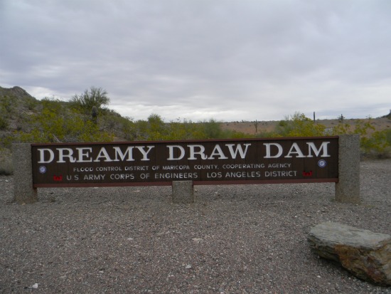
Dreamy Draw Recreation Area
2421 E. Northern Ave.
Ranger Office Phone: (602) 261-8318
Hours: All gated roadways and trailhead parking areas are open 5 a.m. to 7 p.m. Trails remain open until 11 p.m.
Surrounding the base of 2,608-foot Piestewa Peak, the Phoenix Mountains Park and Recreation Area and Dreamy Draw Recreation Area are gateways into diverse desert landscapes that offer everything from fantastic views to secluded valleys. You don't have to fight crowds on the Piestewa Peak Summit Trail to enjoy the area -- the area boasts dozens of miles of trails to enjoy the glory of the Sonoran Desert in relative solitude. While the main trails have names and are periodically marked, you'll find lots of intersecting "use" trails which can make it confusing. Generally, just keep note of which direction Freeway 51 is, and head that way - you'll get back to your car.
Following is information on the main trails that either start or pass thru the Dreamy Draw area. Some are listed with separate trailhead locations, but all are reachable thru Dream Draw, directly or via other trails. See maps online or at the trailheads.
Trail #1A - Perl Charles Memorial Trail
Length: 4.8 miles Elevation: 2,200 ft. - 1,340 ft. Multi-use trail Difficulty: Moderate to difficult The Perl Charles trailhead is located on the east side of 16th Street at the Arizona Canal and is a spur off of the Maricopa County Sun Circle Trail (no parking available). The 16th Street trailhead parking area is open from 5 a.m. to sunset.
The trail follows 16th Street north of Myrtle Avenue, then east along Myrtle and through a tunnel at 19th Street. The trail then follows the wash east to 20th street and north along 20th Street to the Perl Charles Dedication Plaque. Alternate access to the trail at this point is through the horse tunnel at 19th Street and Pleasant Drive just south of Northern Avenue (limited parking available).
Follow the trail signs past the cookout area and east from that point. This loop trail begins to climb one of several saddles into a quiet valley. Then, the trail drops steeply into the largest valley in the preserve system, follows it and then loops back.
Trail #302 - Freedom Trail
Length: 3.74 miles
Elevation: 2,102 ft. - 1,400 ft.
Multi-use trail except on Summit Trail
Difficulty: Moderate to difficult
The trailhead is located at the Apache picnic area at the far end of the parking area in Phoenix Mountains Park and Recreation Area (open from 5 a.m. to 11 p.m.). Paved parking, restrooms and drinking water are available. Dog owners and equestrian users please note that part of this route is on the Summit Trail, from which dogs and horses are prohibited -- you can not complete this loop if you are hiking with a dog or on horseback. Hikers with dogs and equestrian users should be prepared to turn around at the junction with the Summit Trail.
The Freedom and nature trails start and traverse together for about 1/2 mile. At the intersection of 302, 304 and 1A, the Freedom trail turns left and follows the same alignment as the Perl Charles #1A trail for slightly more than a mile. The Freedom trail then breaks away from the Perl Charles and follows a series of switchbacks up the northwest side of Piestewa Peak to meet the Summit Trail to Summit Trailhead, then follow the trail on the north side of the ravine back to the trailhead at Apache area parking lot.
Trail #220 & 220A - Dreamy Draw Nature Trail
Length: 1.5 miles #220; 1 mile #220A
Elevation: 1,580 ft. - 1,380 ft.
Multi-use trail
Difficulty: Easy to moderate
The trailhead is located just north of the parking lot in Dreamy Draw Recreation Area near 19th Street and Northern Avenue. A large paved parking lot, unpaved staging area with hitching racks, horse trough, drinking water and restrooms are available.
Follow the trail east through the horse tunnel and then make an immediate sharp right. Follow the #220 sign posts to the junction with #100. Bear left, follow the nature trail up the hillside, south along the ridge, down the slope and rejoin #100 back to the trailhead.
To take 220A (children's loop) after leaving the trailhead and going through the tunnel, continue on #100 to sign posts marked 220A. Follow 220 back to the trailhead.
Trail #200 & 200A - Mohave Trail
Length: .4 miles
Elevation: 1,788 ft. - 1,480 ft.
Multi-use trail
Difficulty: Easy to moderate
The trailhead is located at the upper parking lot of the Mohave picnic area at Phoenix Mountains Park and Recreation Area. Paved parking, drinking water and restrooms are available.
The trail ascends a short distance to the junction of 200A and turns west along a level pathway to the base of the high peak. Follow the directional arrows up the hill to the hitching rack. Return by the same route or on 200A which will return to Ramada #5 of the Mohave picnic area.
Trail #300 - Summit Trail
Length: 1.2 miles
Elevation: 2,608 ft. - 1,400 ft. (hikers gain more than 1,200 feet in elevation on this trail)
Hiking trail only
Difficulty: Strenuous and Difficult
The trailhead is located in the parking lot at the first driveway on the left in Phoenix Mountains Park and Recreation Area. To reach the trail to the summit of Piestewa Peak, turn east on Squaw Peak Drive from Lincoln Drive between 22nd and 24th streets. Paved parking, drinking water and restrooms are available.
The trail to the summit of Piestewa Peak was first constructed by a wrangler employed at the Biltmore Hotel sometime around 1930. Now, it is one of the most heavily used trails in the nation with 4,000 to 10,000 hikers per week. The trail ascends Piestewa Peak to the highest point in the park. Dogs and bicycles are not permitted on the Summit Trail.
Trail #304 - Nature Trail
Length: 1.52 miles
Elevation: 1,790 ft. - 1,610 ft.
Multi-use trail
Difficulty: Easy to moderate
The trailhead is located at the Apache picnic area at the end of the entrance road in Phoenix Mountains Park and Recreation Area. Paved parking, drinking water and restrooms are available.
The Nature and Freedom trails traverse together about 1/2 mile where the Nature Trail turns right with Trail #1A for a short distance and then turns sharply to the right just past the deep wash. The trail then ascends to a saddle where Trail #8 intersects the Nature Trail, goes down the hill and ends at the Apache picnic area just off from the trailhead.
Trail #8 - L.V. Yates Trail (formally Quartz Ridge Trail)
Length: 2.45 Miles
Elevation: 1,860 ft. -1,640 ft.
Multi-use trail
Difficulty: Easy to moderate
The trailhead is located at the end of 40th Street south of Shea Boulevard at the mountain preserve. The trailhead parking area is open from 5 a.m. to sunset.
The L.V. Yates Trail starts south along the old road and crosses the Christiansen Trail about 1/2 mile south of the trailhead. Make a short right turn at Trail #100 to follow the L.V. Yates Trail. At about one mile the trail makes a sharp right turn (west) and goes in a northwesterly direction to join the Nature Trail #304. An alternate return route can be taken or the L. V. Yates Trail can be taken back to the trailhead.
Do consider the extreme weather potential before heading out on a hike here around Dreamy Draw or anywhere in the Phoenix area, especially if you are a first-time visitor. The best time to hike is October through April when temperatures are moderate or even cool in places. Between May and September though, it can be brutally hot, so head out at sunrise before things really get cooking!
Either way, make sure you're properly outfitted with the right shoes, hiking socks, snacks, day packs and other hiking gear before your next outdoor adventure. Just stop by LowerGear - your local outdoors company in Tempe, easily reached near the intersection of 101 and 202 east of the ASU campus.
Dreamy Draw is just one of our top 10 favorite hiking spots in the Phoenix area. We have trail and hiking information on the other 9 at the links below (with their general location vicinity). Click on the listing for more information on that hiking area.
Estrella Mountains (west Phoenix / Goodyear)
Cave Creek Regional Park (north Phoenix / Cave Creek)
Camelback Mountain (north-central Phoenix)
Piestawa Peak (north-central Phoenix)
Lost Dog Wash (north-east Scottsdale)
McDowell Mountain Regional Park (north-east Scottsdale)
Papago Park (east Phoenix / southwest Scottsdale)
South Mountain (south Phoenix / Ahwatukee)
Usery Mountain (east Mesa)