
No products
This item added to your cart. Calculate any delivery cost at next step.
There are 0 items in your cart. There is 1 item in your cart.
The Goodyear area is blessed with many great wilderness preserves nearby, including some located right inside the incorporated cities within Maricopa County. All feature hiking trails to suit all fitness levels - from relatively flat strolls for casual hikes to trails guaranteed to give even the strongest a good workout.
Visitors from out of town, and even some locals, frequently ask our store staff about a few good places to go hiking, so we've put together our top 10 suggestions for good hikes that are all a short drive from central Phoenix. Some of our favorites are the trails you can hike in and around the Estrella Mountains area:
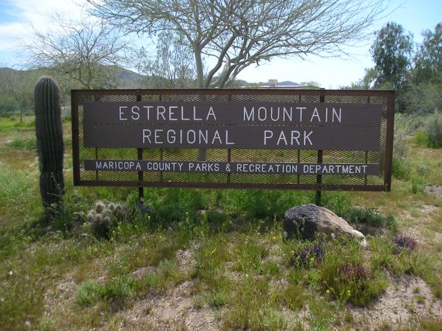
Estrella Mountain Regional Park
14805 West Vineyard Avenue
Goodyear, AZ 85338
Ph: 623-932-3811 Fax: 623-932-7718
From central Phoenix, take I-10 west to Estrella Parkway exit. Travel south to Vineyard Ave. Turn east on Vineyard Ave. to the Estrella Mountain Regional Park entrance on the south side.
Park Hours
Sun-Thu: 6am-8pm
Fri-Sat: 6am-10pm
- 365 days a year
Nature Center Hours
Mon - Sun: 8 am - 4 pm
Admin. Office Hours
Mon - Fri: 8 am - 4 pm
Estrella Mountain Regional Park, comprising approximately 19,840 acres, is the second largest park in the Maricopa County park system. Over 16 square miles of the park are located within the City of Goodyear near the confluence of the Gila, Salt and Agua Fria Rivers.
An incredible asset to the Southwest Valley, most of Estrella Mountain Regional Park remains in its natural state and offers 33 miles of trails for mountain biking, hiking and horseback riding. Park Trails range in length from 2.3 miles to 8.8 miles and range in difficulty from easy to strenuous. If you are looking for an easy, relatively short hike, the 2.4 mile Baseline Trail is recommended. If you are looking for a long, all day hike, the Pederson Trail encompasses 8.7 miles.
Hiking and riding trails are easily accessible via trailheads located at the arena and amphitheater. A mountain bike trail brochure that categorizes trail difficulty is available at the park office. A major competitive mountain biking track offers two loops and eight miles of riding for any skill level and five miles recommended for experts only. The City of Goodyear plans to link its trail system to Estrella Mountain Regional Park's system in the future.
All trails are multi-use unless otherwise designated. Here are the primary trails in the park:
Trail Name Miles KM Use
Baseline 2.6 mi 4.2 km Hike only, round-trip*
Butterfield (front) 0.8 mi 1.2 km Shared use
Butterfield (back) 1.3 mi 2.3 km Shared use
Coldwater 2.9 mi 4.7 km Shared use
Dysart 1.9 mi 3.1 km Shared use
Gadsden 6.1 mi 9.6 km Shared use
Gila 0.5 mi 0.7 km Barrier-Free, round-trip*
Pedersen 6.8 mi 10.9 km Shared use, loop
Rainbow Valley Trail 4.2 mi 6.7 km Shared use
Toothaker Trail 3.7 mi 5.9 km Shared use
Here's what some online reviewers had to say:
It's so hard to find hikes near Phoenix that aren't packed with people. We went on one of the shorter loops and it was wonderful-- we only bumped into two groups the whole time we were gone (about 3 hours). The hikes provide a wonderful view of the city, but they also take you into more wilderness areas where you can really get into nature. The trails are nicely maintained and are clean. Two hearty chihuahuas and two people had a great time and will be going back!
I chose to start with the popular Rainbow Trail, which starts at the rodeo arena and skirts its way along the western edge of the Estrella Mountains. The park map lists the first segment of the trail as being 2.2 miles; however, the rather steep incline of this segment makes it seem much, much longer! The first two miles is little more than a continuous climb from one peak to the next. Fortunately, there are some excellent views of the White Tank Mountains and the West Valley. Eventually, the trail reaches its summit then abruptly quickly descends back to the valley below. (Due to the steepness of the trail as it descends the southside of the mountain, I would highly recommend only following the Rainbow Trail in a counter-clockwise direction!)
After descending down the mountain, the trail continues through the sandy desert valley until intersecting with the Dysart Trail. From this intersection one can either continue deeper into the mountains on the Rainbow Trail or begin looping back towards the trailhead along the Dysart Trail. I chose the easier route of the Dysart Trail and continued through the flat desert valley for another half-mile to the Toothaker Trail.
The Toothtaker Trail is the final mile stretch that continues back to the trailhead. The trail merely continues through the desert lowland around the mountain originally climbed on the Rainbow Trail. The trail itself does provide an easy finish with plenty of desert vegetation and beautiful panoramic views of the surrounding mountain peaks to enjoy.
Do consider the extreme weather potential before heading out on a hike here around Estrella Mountains or anywhere in the Goodyear area, especially if you are a first-time visitor. The best time to hike is October through April when temperatures are moderate or even cool in places. Between May and September though, it can be brutally hot, so head out at sunrise before things really get cooking!
Either way, make sure you're properly outfitted with the right shoes, hiking socks, snacks, day packs and other hiking gear before your next outdoor adventure. Just stop by LowerGear - your local outdoor gear center in Tempe, easily reached near the intersection of 101 and 202 east of the ASU campus.
Estrella Mountains is just one of our top 10 favorite hiking spots in the Goodyear area. We have trail and hiking information on the other 9 at the links below (with their general location vicinity). Click on the listing for more information on that hiking area.
Dreamy Draw (north-central Phoenix)
Lost Dog Wash (north-east Scottsdale)
McDowell Mountain Regional Park (north-east Scottsdale)
Cave Creek Regional Park (north Phoenix / Cave Creek)
Camelback Mountain (north-central Phoenix)
Piestawa Peak (north-central Phoenix)
Usery Mountain (east Mesa)
Papago Park (east Phoenix / southwest Scottsdale)
South Mountain (south Phoenix / Ahwatukee)