
No products
This item added to your cart. Calculate any delivery cost at next step.
There are 0 items in your cart. There is 1 item in your cart.
The Mesa area is blessed with many great wilderness preserves nearby, including some located right inside the incorporated cities within Maricopa County. All feature hiking trails to suit all fitness levels - from relatively flat strolls for casual hikes to trails guaranteed to give even the strongest a good workout.
Visitors from out of town, and even some locals, frequently ask our store staff about a few good places to go hiking, so we've put together our top 10 suggestions for good hikes that are all a short drive from central Phoenix. Some of our favorites are the trails you can hike in and around the Usery Mountain area:
3939 N. Usery Pass Road
Mesa, AZ 85207
Ph: 480-984-0032 Fax: 480-357-1542
userypark@mail.maricopa.gov
Park Hours
Sun-Thu: 6am-8pm
Fri-Sat: 6am-10pm
- 365 days a year
Nature Center Hours
Mon - Sun: 8 am - 4 pm
Admin. Office Hours
Mon - Fri: 8 am - 4 pm
From central Phoenix, I-10 east to US 60 east. Exit Ellsworth Road north to the Usery Mountain Regional Park entrance.
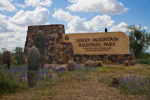
Located on the Valley's east side, this park takes in 3,648 acres set at the western end of the Goldfield Mountains, adjacent to the Tonto National Forest. The park contains a large variety of plants and animals that call the lower Sonoran Desert home. Along the most popular feature of the park, the Wind Cave Trail, water seeps from the roof of the alcove to support hanging gardens of Rock Daisy. The Wind Cave is formed at the boundary between the volcanic tuff and granite on Pass Mountain. Breathtaking views from this 2,840-foot elevation are offered to all visitors.
Usery Mountain Regional Park offers over 29 miles of trails for hiking, mountain biking and horseback riding. Park trails range in length from 0.2 miles to over 7 miles, and range in difficulty from easy to difficult.
If you are looking for an easy, relatively short hike, the Merkle Trail is barrier-free. If you are looking for a long more difficult hike, try the 7.1-mile Pass Mountain Trail. Another visitor favorite is the Wind Cave Trail, that reaches high onto the mountain side and allows hikers onto the adjacent Tonto National Forest.
The trails within the Usery Mountain Regional Park are very popular because they have enough elevation to offer spectacular vistas of surrounding plains. Whether you are looking across the plain, flat land, south of the recreation area, or to the west or north great distances or surrounding mountains can be seen and enjoyed.
All trails are multi-use unless otherwise designated. Details on the primary trails include:
Trail Name Miles KM Use
Amigos Wash 1.2 1.9 km Shared use
Blevins 3.0 4.9 km Shared use
Cat Peaks 1.1 1.8 km Shared use
Cat Peaks Pass 0.3 0.4 km Shared use
Channel 1.2 2.0 km Shared use
County Line 1.0 1.6 km Shared use
Crimson Wash 0.9 1.5 km Shared use
Desert Hawk 0.5 0.8 km Hike only
Levee 1.6 2.6 km Shared use
Meridian 0.9 1.5 km Shared use
Merkle 0.9 1.4 km Barrier-free
Moon Rock 1.4 2.3 km Shared use
Nighthawk Wash 0.5 0.7 km Shared use
Noso 1.0 1.5 km Shared use
Pass Mountain 7.5 12.0 km Shared use
Ruidoso 1.3 2.2 km Shared use
Signal Wash 0.5 0.8 km Shared use
Spillway 1.2 1.9 km Shared use
Vista 0.5 0.8 Hike only
Wind Cave 1.5 2.4 Hike only
Usery Mountain Regional Park offers a campground with 73 individual sites. Each site has a large parking area to accommodate up to a 45' RV and is a "Developed Site," with water and electrical hook-ups, dump station, a picnic table, barbecue grill, and fire ring. Usery Mountain Regional Park provides immaculate restrooms with flush toilets and hot water showers. All sites in the campground may be reserved online at https://www.maricopacountyparks.org/.
Large groups can reserve one of two Usery Mountain Regional Park Group Campgrounds. Each has one large ramada containing six tables, large patio, and shared restrooms with showers. Hookups for RV's are not available. The Group Campground can be reserved for a fee and requires a commitment of six units to utilize that facility for dry camping.
Here's what one online reviewer had to say:I've hiked at Usery Mountain Regional Park quite a few times (and just learned more about it than I ever knew by reading David S. B.'s review). It's kind of a trek from Phoenix, which you don't quite grasp until you have hiked up the mountain and see the Phoenix skyline far off in the distance. I've never seen this place too crowded, though not many people tend to hike mid-June (or maybe they were just there much earlier than we were).
I've seen wildlife here more consistently than any other park I have visited in the Valley. A wide array of lizards from collared lizards to chuckwalas. I've even come across a rattlesnake or two, so keep an eye out! And as with any hike, bring more water than you think you will need. We underestimated our need and had to turn around prematurely....
Do consider the extreme weather potential before heading out on a hike here around Usery Mountain or anywhere in the Mesa area, especially if you are a first-time visitor. The best time to hike is October through April when temperatures are moderate or even cool in places. Between May and September though, it can be brutally hot, so head out at sunrise before things really get cooking!
Either way, make sure you're properly outfitted with the right shoes, hiking socks, snacks, day packs and other hiking gear before your next outdoor adventure. Just stop by LowerGear - your local camping company in Tempe, easily reached near the intersection of 101 and 202 east of the ASU campus.
Usery Mountain is just one of our top 10 favorite hiking spots in the Mesa area. We have trail and hiking information on the other 9 at the links below (with their general location vicinity). Click on the listing for more information on that hiking area.
Piestawa Peak (north-central Phoenix)
Dreamy Draw (north-central Phoenix)
Lost Dog Wash (north-east Scottsdale)
Estrella Mountains (west Phoenix / Goodyear)
Cave Creek Regional Park (north Phoenix / Cave Creek)
Camelback Mountain (north-central Phoenix)
South Mountain (south Phoenix / Ahwatukee)
McDowell Mountain Regional Park (north-east Scottsdale)
Papago Park (east Phoenix / southwest Scottsdale)